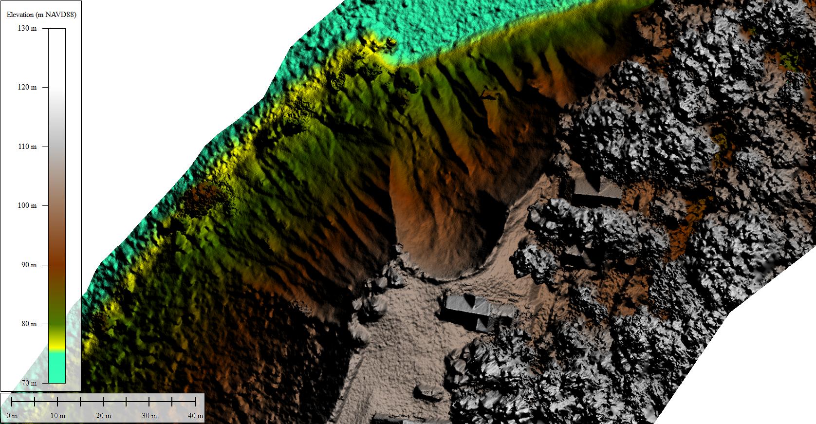
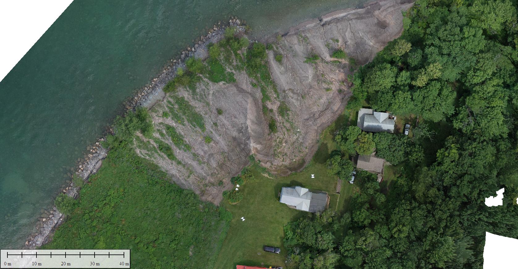
Lake Bluff (Wolcott), New York, July 12, 2017
These overlaid images are a digital elevation model (10-cm resolution) and an orthophoto mosiac (5-cm resolution) made from photos taken from an unmanned aerial system (drone) flown on July 12, 2017. They show the steep bluff above Lake Ontario, some of which has been successfully stabilized, and some of which is rapidly eroding. The erosion has been exacerbated by record-high water levels in Lake Ontario. The bumpy look of open water in the elevation model is an artifact of the photogrammetry process, which expects objects to be stationary in the photos. Instead, small waves were present. Trees with moving leaves also create odd features and are not completely resolved.
These images were collected by the U.S. Geological Survey with support from FEMA and the New York State Departments of State and Conservation.
Grab and drag the green handle to compare images.